
East Orange ZIP Code Evidence
Current official facility addresses provide the strongest support for two East Orange postal ZIPs. The Ampere station uses 07017, while the main East Orange Post Office and Evergreen station use 07018. An archived USPS delivery-scheme document also labels 07019 as East Orange, but that archival reference does not establish current street delivery. Treat each ZIP as an address-validation question, especially when a record comes from a combined Oranges directory, a border street, or an older document.
| ZIP | Areas Covered | Post Office | Notes |
|---|---|---|---|
| 07017 | Ampere-area postal association | Ampere station, 75 Fourth Avenue | Current facility address uses 07017-9994; exact street coverage was not mapped. |
| 07018 | Main and Evergreen station postal association | Main Post Office and Evergreen station | Current facilities use 07018-9997 and 07018-9992; exact street coverage was not located. |
| 07019 | Archived East Orange postal label only | No current facility evidence located | Historical or possible special-use lead; current delivery type and street coverage remain unresolved. |
Neither current facility addresses nor the archival scheme produce a street-by-street boundary map. Full-address validation remains necessary for every record search. The city is about four square miles and borders several municipalities, so a nearby postal label should not substitute for a parcel municipality or an official address result.
East Orange ZIP 07017 and 07018
USPS location information identifies the Ampere station at 75 Fourth Avenue, East Orange, NJ 07017-9994. The East Orange Post Office is listed at 26 City Hall Plaza, East Orange, NJ 07018-9997, and the Evergreen station is at 60 Evergreen Place, Suite 101, East Orange, NJ 07018-9992. Those addresses are strong current postal evidence for 07017 and 07018. They do not identify the exact streets, ZIP+4 ranges, or all delivery routes within either postal area.
Use 07017 or 07018 as a validation lead, not as a claim about a person's city residence. USPS states that a ZIP result confirms a postal match rather than proving that a person or organization is present at the address. When the search begins with a name or a historical directory line, first obtain the complete street address, then run the current postal check and retain the result date.
East Orange ZIP 07019 Caveat
The inspected archival USPS delivery-scheme material labels 07017 through 07019 as East Orange. Current official facility evidence clearly supports 07017 and 07018, but the research did not locate a current official source that defines 07019 as street delivery, a post-office-box ZIP, or another special use. The state ZIP data examined in the research also showed 07017 and 07018. That difference should remain visible in a research note instead of being resolved by assumption.
An older East Orange directory or envelope carrying 07019 is not automatically wrong. It may reflect an older delivery scheme or a special-use arrangement. Cite the historical source and its date, then run the complete address through the current USPS tool before using the ZIP for a present-day record search. Do not use 07019 alone to place an address inside the legal city boundary.
Validate East Orange ZIP Codes
East Orange has no documented official resident roster organized by postal ZIP. The city-linked tax portal and NJGIN Property Explorer accept address or parcel information, but the research did not find official text confirming a ZIP search or filter in either tool. A sound workflow therefore starts with the full address and moves from postal validation to parcel and municipal checks. That avoids turning a broad ZIP label into a claim about a street, household, or city limit.
- Enter the complete street address and city or state in the USPS address tool to obtain the current postal form.
- Save the postal ZIP, ZIP+4 if returned, and the date of the USPS result.
- Use the East Orange property-tax route or NJGIN with the address, municipality, or block and lot to check parcel context.
- Keep postal ZIP, legal municipality, tax municipality, block and lot, and source date in separate fields.
- For a historical directory address, retain the printed ZIP or city wording beside the current USPS result instead of overwriting it.
Once the municipal and postal context is settled, a named-street question belongs with the East Orange street directory. ZIP geography narrows a location; it does not replace the street-level record trail.
USPS East Orange ZIP Lookup
USPS provides three documented ZIP Lookup modes: By Address, By City and State, and Cities by ZIP. By Address uses the street address with city and state, while company is optional. The tool is the right starting point for delivery geography because it returns a current postal validation. Its result still has a narrow meaning. It does not confirm legal municipal boundaries, the occupancy of a property, or a current identity at the address.
| By Address | Use street address plus city and state; company is optional. Best route for a full East Orange address. |
|---|---|
| By City and State | Use the postal city and state to identify ZIP choices. Do not treat the response as a city-boundary table. |
| Cities by ZIP | Use a ZIP to review associated postal city information, then validate a full address separately. |
| Result meaning | A current postal match, not proof that a person or organization resides or operates there. |
If an historic source contains a postal label, maintain both values: the source's original wording and the current USPS response. That preserves the date context and prevents a present-day normalization from erasing a useful historical clue.
East Orange Parcel Search Fields
Parcel data helps separate a postal route from a city or tax jurisdiction. NJGIN describes a statewide Property Explorer that can search New Jersey parcels by address, county, municipality, block, and lot. It also provides parcel, road, address, and imagery information. The research did not document a ZIP field, filter, or complete live parcel-card layout. Use the documented fields as a fallback after USPS validation, not as evidence that a ZIP search is available.
| Field | Type | Documented use | ZIP capability |
|---|---|---|---|
| Address | Text | One route for an all-New Jersey parcel search | Not stated |
| County | Dropdown | Select Essex as one search route | Not stated |
| Municipality | Dropdown | Select East Orange as one search route | Not stated |
| Block and lot | Text pair | Parcel search route; qualifier behavior was not captured | Not stated |
| Map layers | Toggle or checkbox | Parcels, roads, addresses, imagery, and available state layers | No ZIP layer was documented |
New Jersey's NJGIN entry point documents the statewide parcel and Property Explorer route.
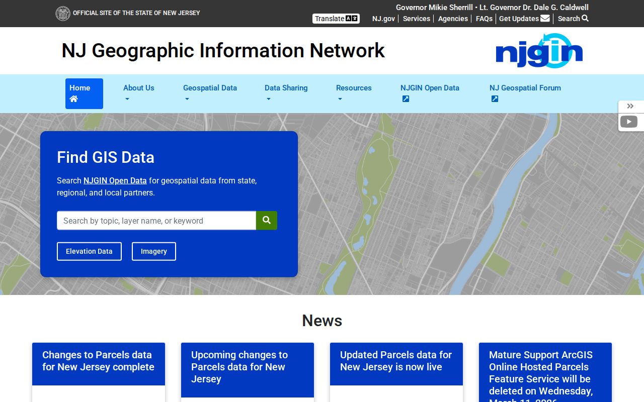
The parcel fallback helps test municipality and block-lot context after a ZIP check, while leaving the postal and legal-geography results as separate facts.
East Orange ZIP Boundary Limits
Postal boundaries can overlap municipal lines or use a postal city name that differs from a legal municipality. No official source in the research established the exact neighboring-ZIP overlap for East Orange. That gap matters because East Orange is adjacent to Orange, West Orange, South Orange, Montclair, Glen Ridge, Bloomfield, and Newark. A border address should be checked against the parcel municipality and deed or tax-map identifiers, not placed by ZIP alone.
- ZIP versus ZIP+4
- A five-digit ZIP identifies a postal area; ZIP+4 adds a more specific delivery segment for the returned address.
- PO-box ZIP
- A ZIP assigned to post-office-box service. The research did not confirm whether 07019 currently has that status.
- Unique ZIP
- A ZIP used for a single organization or special postal purpose, distinct from a general street-delivery area.
- Carrier route
- A delivery grouping used by postal operations; it is not a municipal-boundary designation.
For an address near Newark or one of the Oranges, keep the USPS result beside the parcel municipality and the deed or tax-map identifiers. The values may be related, but they answer different geographic questions.
East Orange Postal Geography
Keep postal geography separate from East Orange planning and civic geography. The city has five wards and plan-area labels including Ampere, Greenwood, Presidential Heights, Arcadian Gardens, Upsala, and Sussex. Those labels are planning or historical references, not a confirmed ZIP map. The Garden State Parkway and I-280 also shape how nearby streets and neighborhoods are described, yet those corridors do not define postal coverage.
For a historic address, retain every label the source provides: street name and suffix, house number, postal city and ZIP, ward or plan area if stated, block and lot, and date. A combined Oranges directory may use a nearby municipality's heading. A ZIP label may do the same. The parcel municipality and legal description give the better route when the sources conflict.
East Orange ZIP Research Limits
Several key details remain unverified: exact 07017 and 07018 street coverage, current ZIP+4 ranges, current delivery type for 07019, the full overlap with neighboring municipalities, and ZIP-filter behavior in the city-linked tax portal or NJGIN. Record those gaps instead of filling them with a neighborhood guess. For a targeted city record, the city maintains street numbering and tax maps through Plans and Construction, while postal validation belongs with USPS.
The East Orange assessor route can help establish property context, and the New Jersey voter-status tool is an individual status check with privacy limits, not a ZIP-organized resident source. For any result, state the narrow fact supported: USPS validates an address to a postal ZIP, or a parcel system identifies a municipality and block-lot context. What remains unknown should be written beside it, especially current occupancy or a disputed city boundary.